- Stats: 991 0
- Posted: July 12, 2021
- Category: What To Do
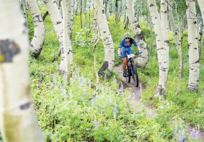
TAPP’s Top 5 Rides in Gunnison County
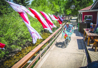
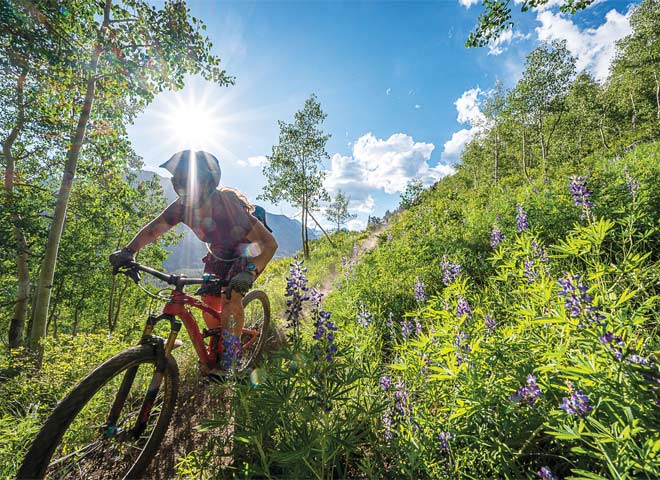
Your bike is tuned up, you’ve got the gear, and you’re ready to ride the world-class trails of the Gunnison Valley. But where to? What trail should you take? Did you mistake that sign for a quick and flowy blue and you’re now headed on a steep and rocky black rollercoaster? Luckily, the Tourism and Prosperity Partnership’s (TAPP) CBGTrails app is the most comprehensive trail map of the Gunnison Valley, ensuring the exact right experience you’re looking for.
Carbon Challenge
Traveling to Crested Butte summer adds carbon to our atmosphere. This year through the CBGTrails app, TAPP invites trail users to combat climate change with the Carbon Challenge. This community challenge allows visitors to record human-powered recreation in an effort to offset the carbon footprint of their trip.
Through this new program unique to the Gunnison Valley, visitors can now offset the environmental impact of their trip by recording a ride, hike, or run using the CBGTrails app. For every mile recorded, users offset 22 pounds of carbon. For example, a 23-mile bike ride in the Gunnison Valley will turn a round-trip drive from Denver into a carbon neutral trip. One hundred miles of human powered activity will offset one tonne of carbon emissions!
TAPP has already purchased UPCO2 tokens. These tokens enable qualified projects to turn their greenhouse gas reductions into tradable carbon credits. As trail miles originating in Gunnison County are tracked, TAPP will retire or “burn” these tokens to support carbon offsetting projects.
The challenge is easy to use and free to join, and will contribute towards a community goal of offsetting 4,253 tonnes of carbon, which is over 9 million pounds of CO2. More info on this challenge can be found at https://gunnisoncrestedbutte.com/carbon/
How to use the CBGTrails app
CBGTrails is free and easy to use. You can download the map areas ahead of your adventure so that you know where you are even if you don’t have cell service. It is available for free in the Google Play and iTunes app stores. Within the CBGTrails app, at the bottom, there is a “Routes” function at the bottom. By searching for routes, users can download the route and then have turn-by-turn navigation for their chosen rides.
Download the app here
1. Best beginner ride
Search “Peanut Lake Rd” in the “Routes” of the CBGTrails app to download turn by turn directions of “Peanut Lake Rd>Lower>Upper Lower>Lower>Woods Walk,” a 7.25 mile beginner ride from Town of Crested Butte.
This is a great beginner loop that will get you up in the Slate River drainage into pristine wetlands, Paradise Divide view sheds and giggly fun single track. This ride starts and finishes right at the edge of the Town of Crested Butte making access a snap! Enjoy stunning views of Gothic Mountain, Mt. Crested Butte and the Slate River.
2. Best intermediate ride
Search “Gateway” in the “Routes” of the app to download turn by turn directions of “Gateway>Josie’s>Buddy Bear>Luge>Graceland>High Five> Cats Cradle> Graceland” a 10.11 mile intermediate loop at Hartman Rocks Recreation Area.
This is becoming one of the most popular intermediate mountain bike loops in the Hartman Rocks area. It starts and finishes at the McCabes Trailhead, which is on the west side of Hartman Rocks. Hartman Rocks is a multi use recreation area just west of Gunnison with trails, camping, rock climbing and off roading. It rides particularly well in the spring and fall when colder weather begins to take hold in the Crested Butte area. You will find technical granite rock formations and flowy single track through sagebrush and high desert terrain. While it is only 30 miles from Crested Butte, the landscape is a world away.
3. Best advanced ride
Search “Walrod” in the “Routes” of the app to download turn by turn directions of “Walrod>Point Lookout>Waterfall Cutoff>Cement Creek Loop” a 19.48 mile advanced loop out of the Cement Creek drainage in Crested Butte South.
This ride has quietly become one of the very best mountain bike loops in Crested Butte. Trail work in the last few years has made what was once a great loop into one of the greatest in the valley. The climb to the top of Double Top Mountain offers up a unique perspective of Mt. Crested Butte and the north end of the Gunnison Valley. You will experience aspen, pine and wide open fields of wildflowers.
4. Best ride from town
Search “Baxter’s” in the “Routes” of the app to download turn-by-turn directions of “Baxter’s>Carbon>Green Lake” a 14.05-mile advanced loop from the Town of Crested Butte.
With the opening of Baxter’s after years of work to get this trail open, this is an instant classic loop. Where else in the USA can one ride a backcountry, alpine loop from town? The climbing up Baxter Gulch is steep. The Carbon trail tops out above 11,000 feet. While you’re catching your breath, check out the gorgeous views of Carbon Peak. Green Lake is a fast, technical descent back to town.
5. Best out-there ride
Search “Canyon Creek” in the “Routes” of the app to download turn by turn directions of “Canyon Creek” a 19.08 mile loop on the western side of Monarch Pass.
The highest trail in the Gunnison Valley and one of the best descents around, this far-flung trail is primed for those that are interested in a daylong adventure. You will climb a four-wheel road that becomes single track and tops out well above tree line. At over 8 miles and 3,000 vertical feet, the climb isn’t for the faint of heart. That said, the work is worth the downhill reward. This remote trail sees very little traffic—you might not see a single other rider.
Related Posts