- Stats: 589 0
- Posted: July 29, 2024
- Category: What To Do
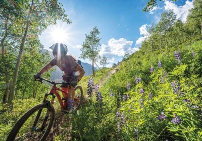
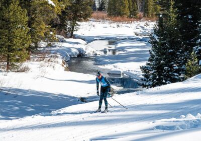
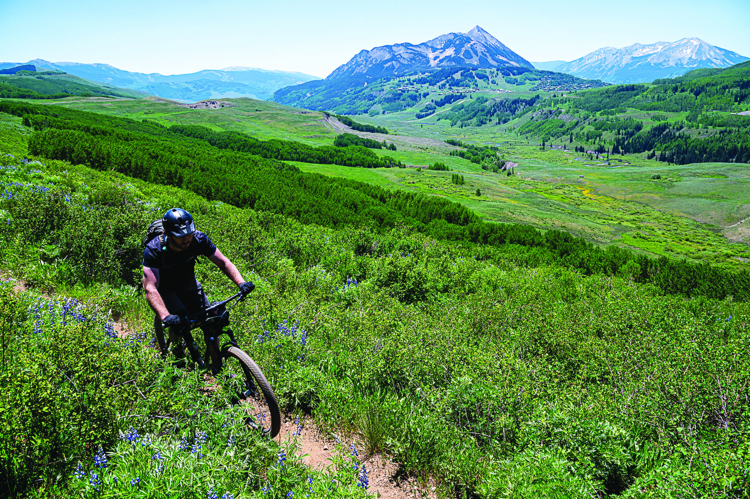
Rides to Remember
From historic trails to new builds, Crested Butte is the crème de la crème for mountain biking
While our friends in Marin County, California often take credit for the birth of mountain biking, Crested Butte’s contributions can not be overlooked. Our mountain bike history began in the early-to-mid 1970s, with local riders shuttling their modified town bikes to high points around the valley and hammering down as fast as possible.
Eventually, riders wanted to get off the roads and start exploring trails under their own power. Many of those early routes were first etched in by dirt bikers, cattle, elk and deer. The Civilian Conservation Corp (CCC) also left a legacy of trail building in Crested Butte from the 1930s.
Beginning in the late 1970s and early 1980s, riders moved beyond reclaiming existing trails and started to scratch in singletrack of their own. The Crested Butte Mountain Bike Association (CBMBA)—the oldest mountain bike club in the world—was founded in 1983. Over the last 40 years, the community’s passion for trail building has blossomed into a force of nature. And now we all get to reap the benefits.
Read on for a collection of some of our favorite Crested Butte rides, from old-school singletrack to modern trails.
—Mike Horn
#1. Beginner Ride
Strand Bonus and Canal Trail Loop
Difficulty: Easy
Distance: 6 miles
Avg. Time: 1.5 hrs.
Climb: 581 ft.
Trail Type: singletrack
Descend: 593 ft.
Non-motorized = no ebikes
This is the easiest mountain bike loop in the Brush Creek Area. Park (or save the planet and ride from Town) at the Brush Creek Trailhead/Parking area on Brush Creek Road, then head NE out Brush Creek Road and look to your right for the turn up Strand Hill Road about a mile up the road. Ride up the road, undoubtedly the hardest part of this loop but plenty manageable with a nice spinning cadence and plenty of viewpoints. 0.7 miles up the road, turn left to continue on Strand Hill Road, then left again 0.2 miles up onto the Strand Bonus Trail. After being recently re-routed and much water diversion work done, this trail is sure to make you smile! At the end of the Bonus, go left again on the Canal Trail. Continue whizzing down the Canal with a smile then hit Brush Creek Road and ride back to your car at the trailhead or all the way to Town.
#2 Intermediate Ride
Classic 401 Loop
Difficulty: Moderate (expert in altitude and a few technical moves)
Distance: 14 miles
Avg. Time: 2.5-5 hrs.
Climb: 2,283 ft.
Trail Type: Singletrack/Road Mix
Descend: 2,265 ft.
Non-motorized = no ebikes
This is the classic loop for riding 401. Starting at the Judd Falls parking area allows you to ride the entirety of 401’s amazing singletrack right back to your car. Better is to ride from the Snodgrass Trailhead for a few more miles, but a lot less impact in the pristine Gothic Corridor.
Trail 401, or Trail Riders Trail as it’s less commonly known, is Crested Butte’s most famous trail for good reason. Lots of intermediate mountain bikers can be found spinning their way up to behold shoulder-high flowers, fast singletrack, and heavenly views of Mt. Crested Butte and the Gothic Valley. Take your time, drink lots of water, and have your camera ready. It gets an intermediate-plus rating due to the steep, but nontechnical climbing involved on 401, especially at the beginning. There are some technical moves and expert moves throughout this loop, but they can be walked.
If you are looking to ride 401 as a shorter loop, start your ride at the turn off for Rustler’s Gulch a few miles past the Judd Fall parking area. Riding from here is about eight miles and still gets you the best part of the 401 singletrack!
#3 Intermediate Ride
Lupine Loop
Difficulty: Moderate
Distance: 13 miles
Avg. Time: 2-4 hrs.
Climb: 1,418 ft.
Trail Type: Paved Bike Path, Dirt Road, Singletrack
Descend: 1410 ft.
Non-motorized = no ebikes
Lupine is a great easy-intermediate ride that is a relatively recent addition to the CBMBA trail network (2011). Starting from town, head up the Rec. Path or Gothic Road towards the town of Mt. Crested Butte/ski area. About a mile up the path/road, you’ll take a left off the Rec. Path, across Gothic Rd. onto Saddle Ridge Rd. which is marked by a sign (headgate) over the entrance.Pedal to the top of Saddle Ridge Rd. where the singletrack clearly begins at the end of the cul-de-sac. About 1/4 mile more of climbing and you’re at your first summit! There is NO PARKING or SHUTTLING to Saddle Ridge Road—you must ride or walk from Town/Mt. CB for this ride.
Lupine 1 then rolls along through the aspens and lupines (duh!) along Smith Hill before descending fun, swooping switchbacks down to a doubletrack dirt road. Head straight off the trail and up the dirt road. Ride up the road over a ‘rollover’, ride past Lupine 2, and climb another 1.8 miles up until you see a left turn onto the Gunsight Connector Trail (aka Lando Calrissian). This trail gives the loop more of an intermediate ranking with its 1.92 mile descent fraught with turns, berms, and switchbacks. There’s a brief climb in the middle that’s sure to make the legs sting a bit, but then it’s downhill to Slate River Road.
The shorter option for this route is to take the Lupine 2 descent instead of climbing the double track road to Gunsight Connector. This will bring you to Slate River Road where you can either pedal north to access the Lower Loop trails, or south which will bring you back to the town of CB more directly.
#4 Advanced
409 to 409.5
Difficulty: Difficult
Distance: 15 miles
Avg. Time: 3-5 hrs.
Climb: 2,500 ft.
Trail Type: Singletrack/Road Mix
Descend: 2504 ft.
Non-motorized (409/Point Lookout) = no ebikes
This is the classic way to ride 409.5 as a loop. The climb to reach 409.5 is long but well worth it! Beginning with some easy road spinning you’ll quickly find yourself on Trail 409 where you’ll encounter some steep technical climbing along with some easier singletrack through the aspen forest. The climb continues when you reach the Point Lookout Trail. Point Lookout was built by CBMBA in 2013, and meanders 2.1 miles up to 409.5. 409.5 is a fast, rooty, loose, technical, but awesome descent. One of the best but hardest to earn in the valley. 409.5 is also a multi-directional moto trail so be aware of uphill traffic. Once you finish 409.5 you have multiple options—back down the way you came for a fast exit, or add Strand Bonus, Strand Hill, Farris Creek, or Strawberry Trail to end your ride and make it a true CB epic.
#5 Advanced
Baxter Gulch to Green Lake
Difficulty: Difficult
Distance: 14 miles
Avg. Time: 3-5 hrs.
Climb: 2,900 ft
Trail Type: Singletrack
Descend: 2,898 ft
Non-motorized = no ebikes
Built to go up and down, Baxter Gulch was made for mountain bikes. This loop is an instant classic for several reasons! The first being its proximity to downtown Crested Butte, allowing for some great refreshments after your ride. The second being the character of the new Baxter Gulch Trail (completed 2018), which creates a very scenic climb to the flanks of Whetstone Mountain. With some steep pitches, this beauty climbs in earnest, but it is so worth it. After the ‘Baxter Saddle’ and some stunning views to the south, you descend the final bit of Baxter Gulch to the Carbon Creek Trail (#436). Turn right on Carbon Creek, and enjoy the hard work the USFS has done to re-route some of these formerly unsustainable sections. Although chunky it eventually becomes a great and rowdy downhill trail. Carbon intersects with the Green Lake Trail— turn right to descend down to Town, or take a left turn to go jump in the lake before heading down and enjoying one of Crested Butte’s best downhills.. Green Lake descends more than four miles of steep, rooty, flowy goodness on primo dirt! Do be aware of hikers going both directionsGreen Lake is a popular hiking trail too. Ring that bell!
Pro tip: Start your ride in the town of CB and not at the Baxter Gulch trailhead. This way you can finish at the bar and not with a climb.
#6 Intermediate
CB South Lunch Ride – Lower Middle Cement Creek Trail
Difficulty: Intermediate
Distance: 6 miles
Avg. Time: 1.5 hrs
Climb: 1,600 ft.
Trail Type: Singletrack
Descend: 1,600 ft.
Non-motorized = no ebikes
A classic ‘lunch loop’ for CB South, this is a great way to get some dirt, get some mountains, get some climb, and get some downhill love back after earning it. It’s a six-mile loop from the Caves Trailhead, or add three miles and do less damage in the car by riding from Camp 4 in CB South This is the best way to get a true CB classic bit of track in a short amount of time. Start with a wee bit of dirt road on Cement Creek Road, and quickly jump on to the Lower Cement Creek Trail, to Walrod Road. Up you go on Walrod Road, riding to the top of it where “The Wall” begins. From here you go right onto the Warm Springs Trail, the only motorized portion of track.. Drop down this fun little start to your good times and look for the quick right turn onto the Lower Middle Cement Creek Trail—known as the Stumpjumper section. Descend one mile of sweet trail bliss, built in 2019, for the highlight of the ride. There’s the true ‘stumpjump’ in there, along with some technical features, but nothing too over the top, or nothing one can’t jump off the bike quickly to avoid. When finished and giggling, turn right onto the Lower Cement Creek Trail for a great and friendly finish on flowy track to your start. Include the upper portions of the new Middle Cement Creek Trail for longer and more epic rides.
#7 Intermediate and Expert
Mogul Storage Trails
Difficulty: Intermediate and Expert
Distance: 0.6-mile loops
Avg. Time: per laps
Climb: 250’ from TH, 230’ per lap
Trail Type: Singletrack/Wide Track – Flow Trails
Descend: 230 ft.
Built in 2022, these new additions to the trail system were much needed, and we’re grateful to have them so close to town. Great for a ride in and of themselves, they make for a great skills and technique practice area and combine a little bit of uphill with some sweet downhill flow-trail fun. Starting at the Baxter Gulch Trailhead, begin by climbing up 250 feet on the Baxter Gulch Trail itself before seeing the turn off for the Mogul Storage Trails (MST). The far trail is the intermediate trail, and intermediate it is! No mandatory jumps, but there are some steep fast sections, big insloping berms, and “moguls” to jive and jam with on the way down. Then turn back up on the Baxter Gulch Trail to go up for more and keep practicing. The Mogul trails are fun in and of themselves, and mix in some good exercise with the uphill portion. It’s a great way to stay close to town, get some climbing, some views, some smiles, and some DH flowy fun in.
Take the expert Mogul Storage Trail for more of a challenge. Still no mandatory airs if you’re just taking your time down it, but there is the opportunity to go big and work the “moguls” in a flowy, fun, featured little bit of wide-track. The downhill trails are each nearly 0.3 miles, and the uphill is 0.8 miles from the TH, or only 0.6 miles if you are lapping up the Mogul Storage Trails (MST) from the finish.. Ride up Baxter Gulch Trail further to add to the ride, or get a little more uphill in your ride before coming back to session the MST. Great with the kids, great if trying to sneak something in before the rain, great to go up and down over and over again!
For even more rides, check out crestedbuttemountainbike.com/trail-information/rides/
Related Posts